Miami Beach weatherWhat’s on in Miami Beach →
Fort Lauderdale

Get out of town

Day trips from Miami Beach

15 nearby parks, towns and places to explore, ordered by straight-line distance.

John U. Lloyd Beach State ParkState park

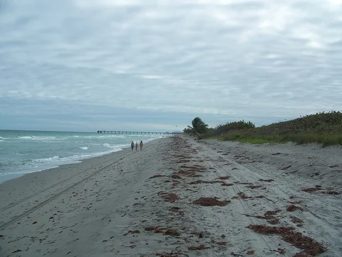
John U. Lloyd Beach State Park

17 miles north · straight-line distance

State park in Florida, United States.

Confirm the visitor entrance, hours, reservations, access and seasonal conditions. Islands or water destinations may require different transport.
Fort LauderdaleTown

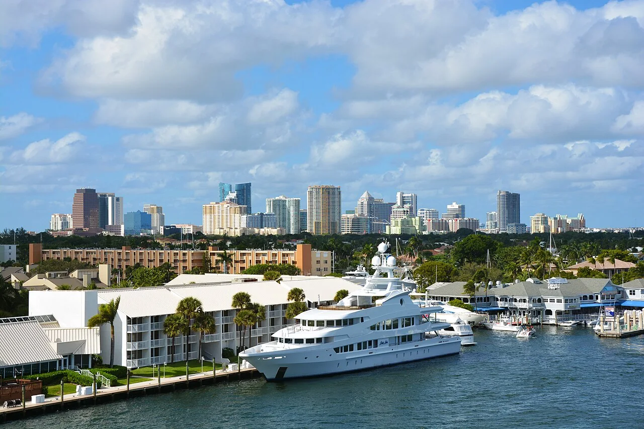
Fort Lauderdale

21 miles north · straight-line distanceAbout 35 min by car (31 road miles, typical traffic, checked October 2026)

City in and seat of Broward County, Florida, United States.

Confirm the visitor entrance, hours, reservations, access and seasonal conditions. Islands or water destinations may require different transport.
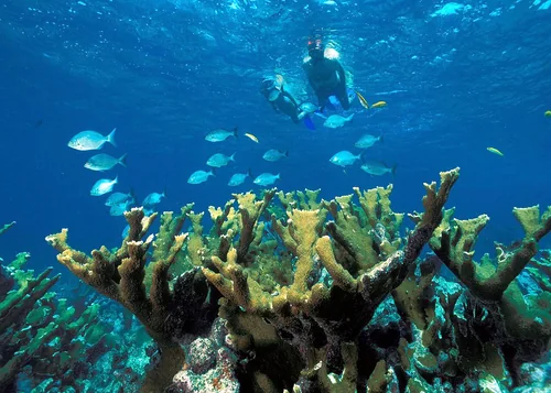
Zoo MiamiThings to do

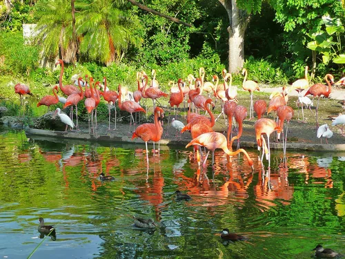
Zoo Miami

22 miles southwest · straight-line distanceAbout 40 min by car (29 road miles, typical traffic, checked October 2026)

Zoological park and garden in Miami, in the United States.

Confirm the visitor entrance, hours, reservations, access and seasonal conditions. Islands or water destinations may require different transport.
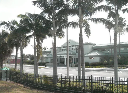
State park

Hugh Taylor Birch State Park

22 miles north · straight-line distance

Florida state park.

Confirm the visitor entrance, hours, reservations, access and seasonal conditions. Islands or water destinations may require different transport.
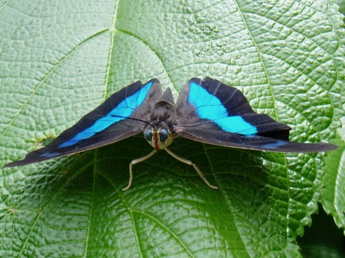
Biscayne National ParkNational park site

Biscayne National Park

23 miles south · straight-line distance

180,000 acres of mostly waterways, in Florida (US), managed by the National Park Service.

BoatingCampingFishingPaddlingAgency site ↗

Confirm the visitor entrance, hours, reservations, access and seasonal conditions. Islands or water destinations may require different transport.
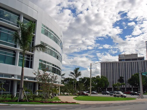
Oakland ParkTown

Oakland Park

24 miles north · straight-line distanceAbout 40 min by car (34 road miles, typical traffic, checked October 2026)

City in Florida, United States.

Confirm the visitor entrance, hours, reservations, access and seasonal conditions. Islands or water destinations may require different transport.
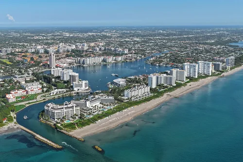
Town

Pompano Beach

28 miles north · straight-line distanceAbout 40 min by car (37 road miles, typical traffic, checked October 2026)

City in Broward County, Florida, United States of America.

Confirm the visitor entrance, hours, reservations, access and seasonal conditions. Islands or water destinations may require different transport.
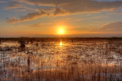
Butterfly WorldThings to do

Butterfly World

31 miles north · straight-line distanceAbout 45 min by car (40 road miles, typical traffic, checked October 2026)

World's largest butterfly aviary, Florida, USA.

Confirm the visitor entrance, hours, reservations, access and seasonal conditions. Islands or water destinations may require different transport.
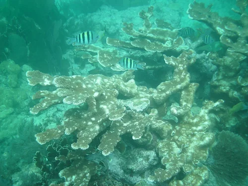
Coral SpringsTown

Coral Springs

32 miles north · straight-line distanceAbout 50 min by car (48 road miles, typical traffic, checked October 2026)

City in Broward County, Florida, United States.

Confirm the visitor entrance, hours, reservations, access and seasonal conditions. Islands or water destinations may require different transport.
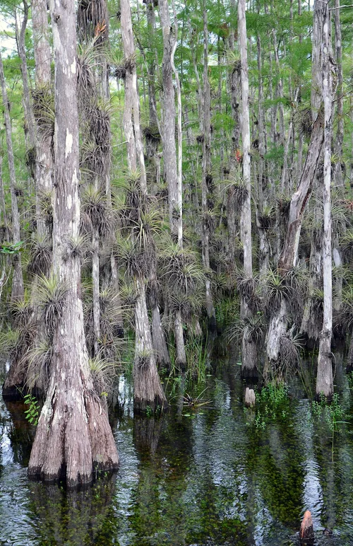
Boca RatonTown

Boca Raton

38 miles north · straight-line distanceAbout 50 min by car (48 road miles, typical traffic, checked October 2026)

City in Palm Beach County, Florida, United States.

Confirm the visitor entrance, hours, reservations, access and seasonal conditions. Islands or water destinations may require different transport.

Everglades National ParkNational park site

Everglades National Park

50 miles southwest · straight-line distance

One-and-a-half million acres in Florida (US) managed by the National Park Service.

Confirm the visitor entrance, hours, reservations, access and seasonal conditions. Islands or water destinations may require different transport.

John Pennekamp Coral Reef State ParkState park

John Pennekamp Coral Reef State Park

52 miles south · straight-line distance

State park located on Key Largo, Florida, USA.

Confirm the visitor entrance, hours, reservations, access and seasonal conditions. Islands or water destinations may require different transport.

Big Cypress National PreserveNational park site

Big Cypress National Preserve

56 miles west · straight-line distance

729,000-acre area in Florida (US) managed by the National Park Service.

Confirm the visitor entrance, hours, reservations, access and seasonal conditions. Islands or water destinations may require different transport.

Outdoors

Jupiter Island

83 miles north · straight-line distance

Island in Martin County, Florida, United States.

Confirm the visitor entrance, hours, reservations, access and seasonal conditions. Islands or water destinations may require different transport.

Lake

Lake Okeechobee

88 miles northwest · straight-line distance

Freshwater lake in the state of Florida, USA.

Confirm the visitor entrance, hours, reservations, access and seasonal conditions. Islands or water destinations may require different transport.

Driving times are typical estimates from the city center without live traffic, Powered by Geoapify · © OpenStreetMap contributors.

Distances are straight-line measurements from the city, not driving distance. Saved road estimates have no consistently recorded source date and are not current traffic; estimates to park centers, water locations or inconsistent routes are omitted. Named-destination route links are not verified entrances. Place descriptions come from Wikidata; photo credits below include recorded capture dates when available. A photograph does not show current conditions.

Outdoor places near Miami Beach

28 recreation areas and campgrounds within 131 miles, from Recreation.gov. Filter by what you want to do.

Campground

Boca Chita Campground

21 miles south · straight-line distanceNational Park Service

Boca Chita Key is only accessible by boat. No services are available on the island. Boca Chita Key is the park's most popular island. It features beautiful waterfront views, a grassy camping area, picnic tables and grills.

CampingPicnicking

Recreation area

Biscayne National Park

24 miles south · straight-line distanceNational Park Service

Within sight of Miami, yet worlds away, Biscayne protects a rare combination of aquamarine waters, emerald islands, and fish-bejeweled coral reefs.

BoatingCampingFishingPaddling

Campground

Elliot Key Campground

26 miles south · straight-line distanceNational Park Service

Eliott Key is only accessible by boat. No services are available on the island. Elliott Key is the park's largest island. Restrooms with sinks and cold water showers, picnic tables and grills are available.

CampingHikingPicnicking

Recreation area

Crocodile Lake National Wildlife Refuge

46 miles south · straight-line distanceFish and Wildlife Service

Crocodile Lake National Wildlife Refuge was established in 1980 to protect critical breeding and nesting habitat for the endangered American crocodile and other wildlife.

Ranger programs

Recreation area

Arthur R. Marshall Loxahatchee National Wildlife Refuge

47 miles north · straight-line distanceFish and Wildlife Service

The Loxahatchee National Wildlife Refuge was established in 1951 under the authority of the Migratory Bird Conservation Act of 1929 with a 50-year license agreement between the State of Florida and the U.S.

BikingBirdingBoatingEducational ProgramsFishingHikingHorseback ridingHunting

Campground

Pinecrest Group Campground

49 miles west · straight-line distanceAbout 1 hr 10 min by car (54 road miles, checked October 2026)National Park Service

Pinecrest Campground offers four group campsites that provide a nice, quiet and relaxing atmosphere. This is a wonderful location for a group to start their south Florida adventure.

BikingCampingFishingHikingHistory

Campground

Midway Campground (FL)

53 miles west · straight-line distanceAbout 1 hr 10 min by car (60 road miles, checked October 2026)National Park Service

Midway Campground is a beautiful place where visitors can enjoy the surrounding preserve while sitting at their picnic table.

Camping

Recreation area

Everglades National Park

56 miles southwest · straight-line distanceNational Park Service

Established in 1947 as the first national park created for its biodiversity, Everglades National Park protects 1.5 million acres of wetland, forest, and marine habitats and the native plants and animals that call it home.

BikingBoatingCampingFishingHikingPaddlingPicnickingWildlife viewing

Recreation area

Big Cypress National Preserve

60 miles west · straight-line distanceNational Park Service

The freshwaters of the Big Cypress Swamp, essential to the health of the neighboring Everglades, support the rich marine estuaries along Florida's southwest coast.

BikingBoatingCampingFishingHikingHistoryHuntingPaddling

Campground

Monument Lake Campground

61 miles west · straight-line distanceAbout 1 hr 15 min by car (68 road miles, checked October 2026)National Park Service

Monument Lake Campground is a beautiful place where visitors can enjoy the surrounding preserve while sitting at their picnic table.

CampingFishingHunting

Campground

Burns Lake Campground

68 miles west · straight-line distanceNational Park Service

Burns Lake Campground offers lake views from every campsite. Offering direct backcountry access, this campground is the ideal place for hunters and off-road vehicle enthusiasts.

CampingFishing

Campground

Gator Head Campground

76 miles west · straight-line distanceAbout 2 hr 30 min by car (108 road miles, checked October 2026)National Park Service

Gator Head Campground is a primitive campground located within the Bear Island Unit of Big Cypress National Preserve.

BikingBirdingCampingFishingOff Road Vehicle TrailsWildlife viewing

Recreation area

Jupiter Inlet Lighthouse Outstanding Natural Area

78 miles north · straight-line distanceBureau of Land Management

The Jupiter Inlet Lighthouse Outstanding Natural Area (ONA) is part of the Bureau of Land Management’s 27-million acre National Conservation Lands; and the only complete unit east of the Mississippi River.

BoatingDivingHikingHistoryNature educationPaddlingPhotographyPicnicking

Recreation area

Florida Panther National Wildlife Refuge

80 miles west · straight-line distanceFish and Wildlife Service

Established in 1989, Southwest Florida’s Florida Panther National Wildlife is located within the heart of the Big Cypress Basin, encompassing the northern reach of the Fakahatchee Strand, the largest cypress strand in the Big Cypress…

BirdingHikingHuntingPhotographyRanger programsWildlife viewing

Recreation area

Lake Okeechobee

81 miles northwest · straight-line distanceUS Army Corps of Engineers

As lake, waterway and surrounding countryside, Okeechobee shows the many faces of Florida. A canopy of moss-draped live oaks hides clusters of sabal palms. A tangle of water plants marks the boundary where wetland meets lakeshore.

BoatingCampingFishingHikingHotel/Lodge/Resort Privately OwnedNature educationPicnickingWater sports

Recreation area

Nathaniel P. Reed Hobe Sound National Wildlife Refuge

84 miles north · straight-line distanceFish and Wildlife Service

Nathaniel P. Reed Hobe Sound National Wildlife Refuge contains the largest contiguous section of undeveloped beach in Southeastern Florida and is considered one of the most productive sea turtle nesting areas in the Southeastern United…

FishingHikingNature educationPhotographyRanger programsWildlife viewing

Campground

St Lucie South

89 miles north · straight-line distanceAbout 1 hr 45 min by car (104 road miles, checked October 2026)US Army Corps of Engineers

St. Lucie Campground provides a relaxing camping experience on the St. Lucie Canal, part of the 152 mile Okeechobee Waterway that spans South Florida from the Atlantic Ocean to the Gulf of Mexico.

BirdingBoatingCampingCanoeingFishingHiking

Recreation area

Ten Thousand Islands National Wildlife Refuge

89 miles west · straight-line distanceFish and Wildlife Service

Ten Thousand Islands National Wildlife Refuge was established in 1996 under provisions of the Arizona-Florida Land Exchange Act of 1988.

BikingBirdingCampingFishingHikingHuntingNon-Motorized BoatingWildlife viewing

Campground

Ortona South

99 miles northwest · straight-line distanceAbout 2 hr 5 min by car (121 road miles, checked October 2026)US Army Corps of Engineers

Ortona South is a perfect campground for a quiet, sunny escape to South Florida. The campground is set along the Caloosahatchie River.

BikingBirdingCampingFishing

Recreation area

Rookery Bay National Estuarine Research Reserve

99 miles west · straight-line distanceNational Oceanic and Atmospheric Administration

An amazing world exists within the pristine mangrove-fringed waterways, uplands and freshwater wetlands that can be found only a few miles away from downtown Naples.

BoatingCampingDivingHikingHistoryPaddlingPhotographyRanger programs

Recreation area

National Key Deer Refuge

110 miles southwest · straight-line distanceFish and Wildlife Service

NATIONAL KEY DEER REFUGE The National Key Deer Refuge was established in 1957 to protect and preserve the national interest the Key deer and other wildlife resources in the Florida Keys.

BoatingRanger programs

Campground

W.P. Franklin N

115 miles northwest · straight-line distanceAbout 2 hr 35 min by car (156 road miles, checked October 2026)US Army Corps of Engineers

Visitors flock to W.P. Franklin Campground for its well-kept facilities and location on the Caloosahatchee River, where campers can fish, boat and take it easy in sunny southwest Florida.

BirdingBoatingCampingFishingKayaking

Campground

W.P. Franklin South Recreation Area

115 miles northwest · straight-line distanceAbout 2 hr 30 min by car (155 road miles, checked October 2026)US Army Corps of Engineers

WP Franklin South Recreation Area is a day use area located on the Caloosahatchee River adjacent to the WP Franklin Lock and Dam.

BoatingCampingCanoeingFishingKayakingPicnicking

Recreation area

Caloosahatchee National Wildlife Refuge

119 miles northwest · straight-line distanceFish and Wildlife Service

The refuge was established by President Woodrow Wilson on July 1, 1920, through Executive Order 3299 as a ". . . preserve and breeding ground for native birds" upon the recommendation of Thomas and Mina Edison.

Boating

Recreation area

Florida Keys National Marine Sanctuary

121 miles southwest · straight-line distanceNational Oceanic and Atmospheric Administration

As soon as you step into the waters of the Florida Keys, you have entered Florida Keys National Marine Sanctuary.

BoatingDivingFishingHistoryPaddlingPhotographyRanger programsSnorkeling

Recreation area

Matlacha Pass National Wildlife Refuge

123 miles west · straight-line distanceFish and Wildlife Service

The islands contain two basic vegetative zones, upland sand ridges and mangroves. Several islands of the Matlacha Pass NWR are used as roosting and nesting sites for a variety of colonial water birds including the brown pelican, great…

Boating

Recreation area

Great White Heron National Wildlife Refuge

125 miles southwest · straight-line distanceFish and Wildlife Service

Great White Heron National Wildlife Refuge was established in 1938 as a haven for great white herons, migratory birds, and other wildlife.

BoatingPaddling

Recreation area

J.N. "Ding" Darling National Wildlife Refuge

131 miles west · straight-line distanceFish and Wildlife Service

J.N. "Ding" Darling National Wildlife Refuge, on the subtropical barrier island of Sanibel in the Gulf of America along Florida’s west coast, is part of the largest undeveloped mangrove ecosystem in the United States.

BikingBirdingBoatingEducational ProgramsFishingHikingMotor BoatNature education

Recreation areas and campgrounds from Recreation.gov's directory, checked October 9, 2026. Listings are not live availability: check Recreation.gov or the managing agency for open dates, fees, reservations and conditions. Directions go to the listed coordinates, which may not be the entrance. Campground driving times: Powered by Geoapify · © OpenStreetMap contributors.

Questions

What day-trip ideas are near Miami Beach?

This guide includes John U. Lloyd Beach State Park, Fort Lauderdale, Zoo Miami, Hugh Taylor Birch State Park, Biscayne National Park. Places are ordered by straight-line distance. Confirm visitor access, opening hours and current travel conditions before choosing a trip.

How far is John U. Lloyd Beach State Park from Miami Beach?

Approximately 17 miles north in a straight line. This is not current traffic or a route to a verified visitor entrance. Use the named destination and confirm the appropriate entrance or transport.

How far is Fort Lauderdale from Miami Beach?

Approximately 21 miles north in a straight line; driving takes about 35 min over 31 road miles in typical traffic (Geoapify, checked October 2026). This is not current traffic or a route to a verified visitor entrance. Use the named destination and confirm the appropriate entrance or transport.

How far is Zoo Miami from Miami Beach?

Approximately 22 miles southwest in a straight line; driving takes about 40 min over 29 road miles in typical traffic (Geoapify, checked October 2026). This is not current traffic or a route to a verified visitor entrance. Use the named destination and confirm the appropriate entrance or transport.

Where can I camp near Miami Beach?

Recreation.gov lists 11 campgrounds within 115 miles, including Boca Chita Campground (21 miles south), Elliot Key Campground (26 miles south), Pinecrest Group Campground (49 miles west). Check Recreation.gov for current availability, seasons and reservations.

Miami Beach AI

Your Miami Beach local guide
Hey there!

I'm Miami Beach AI. Ask about neighborhood food, independent shops, local history or planning a visit.

AI recommendations may be inaccurate. Verify hours and prices. Questions are processed by Cloudflare. Privacy